My long journey following the Mullum Mullum Creek is nearly at an end. My last day of walking started near where I left the creek next to the Templestowe Terminal Station.
Getting into this area by car is a little tricky. By following the extension of Blackburn Road across Warrandyte Road you end up in the Templestowe Industrial Estate, then you go between some stone gate posts into The Parkway, this road has parkland on one side and the terminal station on the other, it turns the corner, crosses the creek on a single lane bridge and suddenly you are in the middle of a small, very up market housing estate.
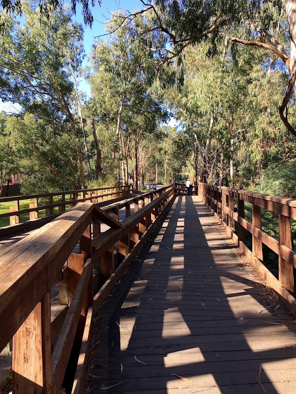
The bridge is also part of the Mullum Mullum Trail. I didn’t know it at the time but this was the last view I would have of the creek for quite a while.
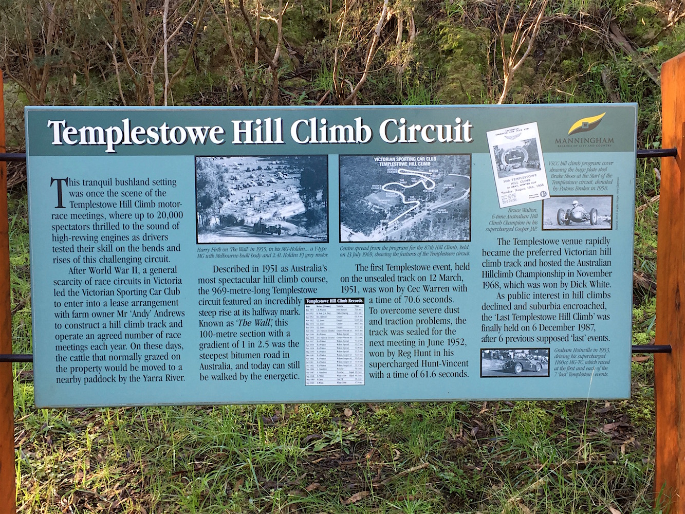
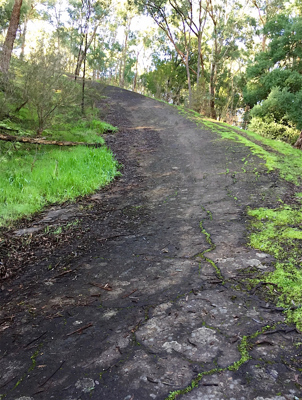
The housing estate is on a very steep hill that was formerly the Templestowe Hill Climb. There is now a walking trail on part of the old track. There is a lot of information on the sign at the base of the climb.
Built by the Victorian Sporting Car Club in 1951 it was famous for the steep climb halfway along known as The Wall. From a 2003 Age article about the course:
The farm at the top of Blackburn Road was home to an implausibly steep rise, effectively an escarpment, on which a section of track was built that was known as The Wall. It stretched for about 100 metres at a gradient, measured in feet, of 1 to 2.5.
Hill climb competitors, who are usually amateurs driving their own cars, race against the clock over a course from A to B. At Templestowe, the track was 969 metres. The rise of The Wall at the halfway mark gave it something special.
The track was unsealed at the first event, held on March 12, 1951. The dust was shocking but the greater problem was the inability of tyres to grip the shifting surface of The Wall. Most cars slid to an ignominious stop in The Hole.
By the second Templestowe hill climb, more than a year later, the track was sealed and The Wall was the steepest section of bitumen road in Australia. Any steeper and the tarmac would have slid down the hill before it had set.
Images from Speedway and Road Race History give an indication of what it was like to drive up this almost impossible slope. And here I was about to attempt to walk up it on a winter day when it was covered in slippery wet leaves.
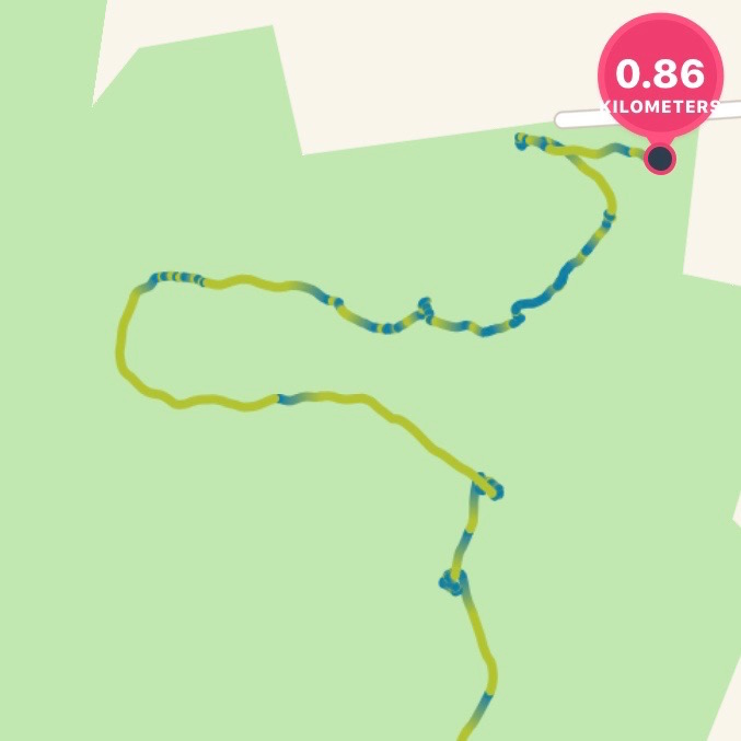
I started out well, pausing to take a photo every now and then, but once I turned the bend, the slope increased and I wondered if it was a road too steep. The screenshot from my fitbit tells the story. Green is a normal pace, blue is virtually standing still.
At times I thought I was going to fall off the face of the earth!
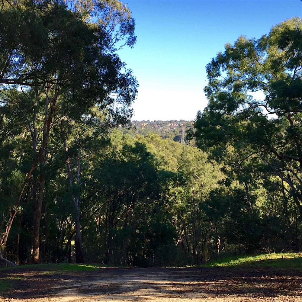
However I did successfully make it to the top. Trees have grown but you can still see the same view, with the pylons far below.
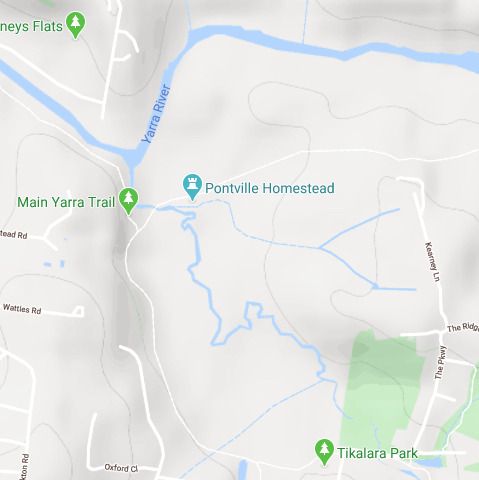
After this challenging diversion it was back the the Mullum Mullum Trail. It goes through Tikalara Park which is actually most of the area of this map. The Hill Climb is near the top of the green area; the dark smudge is The Wall.
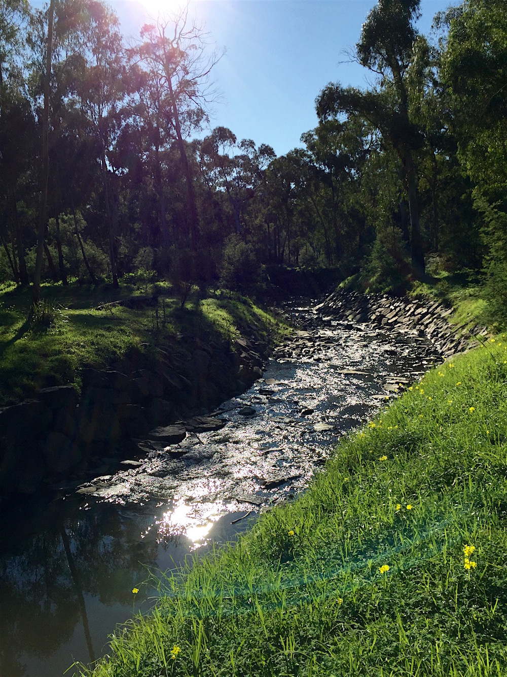
The first section of my walk is the horizontal bit at the bottom, up to the small watercourse.
After crossing the bridge, and before crossing The Parkway I could see another mob of kangaroo enjoying the sun. The trail turns uphill away from them and follows the powerlines. At the end of this section is a stencil, this is the end of the Mullum Mullum Trail. From here on I follow the Main Yarra Trail, which you can see coming up from the bottom of the above map.
After crossing the little tributary, it is not long before I am in a delightful avenue. Each of the trees has an individual number tag, I assume it is part of Parks Victoria’s management.
The path follows the contour line, slightly above and well away from the creek itself. This section of the river flat between the path and the creek is manicured grass.
Then, after going through a gate the path is still elevated and there is a wetland full of frogs. I did venture off the path and across to the creek, picking my way very carefully to avoid the boggy bits. Here there were more kangaroos, not so used to people I suspect as they left very quickly.
The trail and creek finally meet again near the last bridge. Unfortunately, while maps have a walking track crossing this bridge and heading back east, this is not possible.
The direction sign to this track has been removed from the board and the bridge is well and truely closed. Now the only option is to head to the City 36.5 km away.
Following that trail, onto a boardwalk here there is a good view of the final bend in the Mullum Mullum Creek…
and a first glimpse of the Yarra River.