It has taken me far to long to visit this flora reserve. I remember when the land was bought by Croydon Council for a very small amount in the 1980s in order to preserve its wonderful biodiversity. After going through a number of management iterations it is now controlled by Parks Victoria.
The ridge runs north-south in Croydon North with views past Lilydale to Mount Toolebewong and the Yarra Ranges National Park. The biggest risks to the reserve include flower pickers.
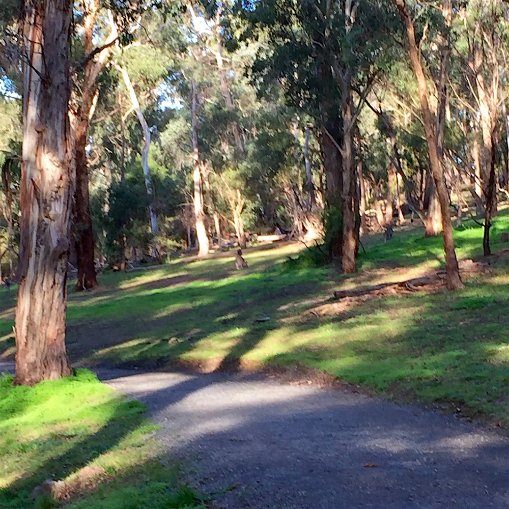
I parked in a nearby residential court and made my way up to the ridge track. It was a very sunny day and I did not want to linger near the small water course and pond in case of snakes. The 18.6 hectare reserve has 250 indigenous plant species many of which are rare at the local and regional level. The trees are mainly Red Stringybark, the reserve is known mainly for its 13 wattle species and nearly 30 orchid species.
I was too late to see orchids, but hoped to see some of the later blooming wildflowers. By looking very carefully I was able to find these beauties including Common Fringed Lily, Button Everlasting, and lots of Blue Pincushion.
There were fragrant Chocolate Lily everywhere, nodding in the breeze, so it was very hard to get a photo. Other sightings were the Common Rice Flower, Annual Blue Bells and Yellow Stars. The seedpods maybe from Milkmaids.
Grasses were plentiful with the introduced Quaking Grass beside all the paths. There was also lots of the pretty but pesky Delicate Hairgrass and some interesting but unidentified plants, maybe Sweet Vernal Grass.
By going a little way in to the bush I found Wattle Mat Rush and Red-Anther Wallaby Grass.
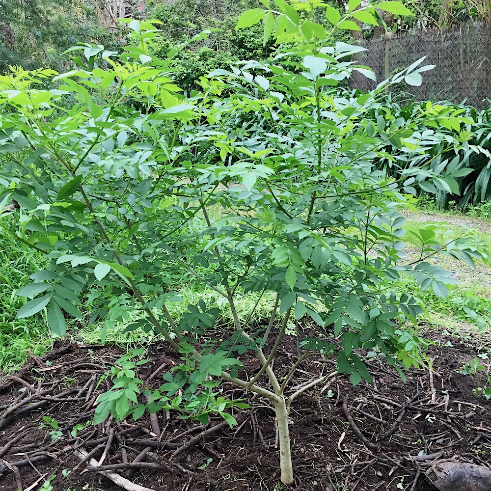
One of the flowering trees really stood out and I hope to find out what it is and if I can add one to my garden. From the foliage I am guessing a She-oak.
The understory at the top of the ridge was otherwise dominated by Cassinia longifolia in full flower.
The reserve is well worth exploring and I intend to return at different times of the year. The only downside is being elevated, the sound of traffic from Maroondah Highway and Holloway Road cannot be ignored. Housing is also very close by when using the perimeter track.
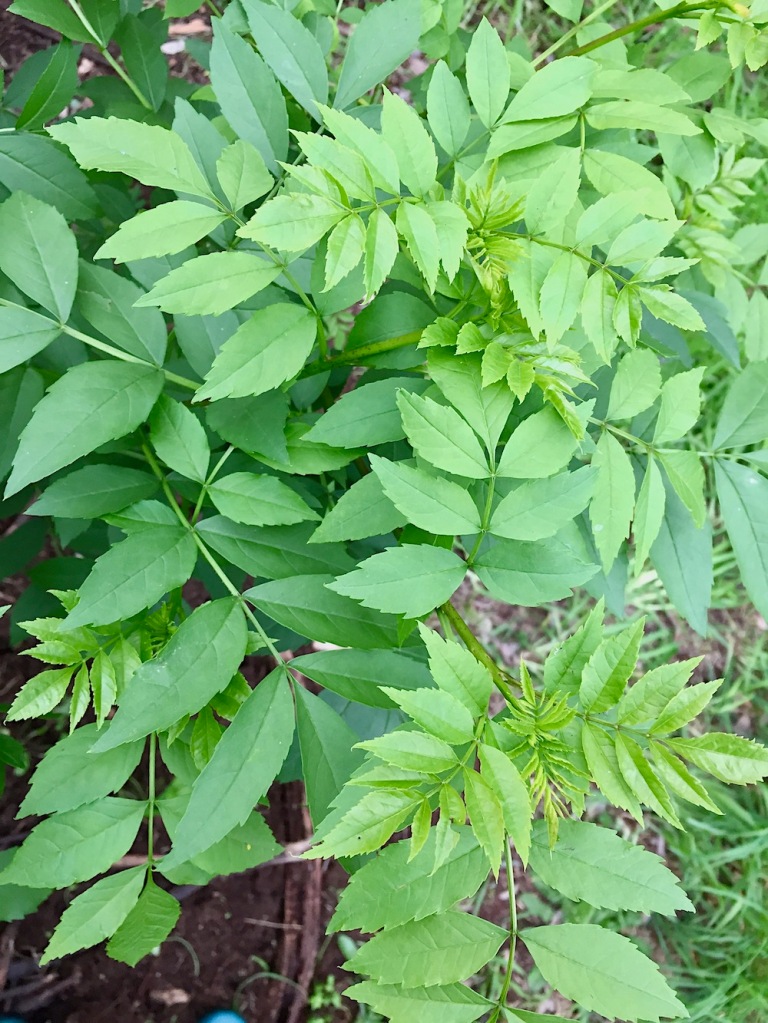
Vireya thought that the self sown tree that appeared in my garden might have been a Melia azedarach a rather pretty rainforest tree. It is a deciduous native tree also found in Asia. I have one of these and so when I found another little Desert Ash growing in the garden I was able to do a direct comparison.
Here are the leaves of the two plants close together, very similar indeed. But already it is obvious the Melia azedarach leaves on the lower right are slightly glossy and the serrations on the edges are rounder.
Desert Ash
Melia azedarach
Another difference is the way the leaves grow out from the leaf stem. Those of the Meliaazedarach branch out on opposite sides down the whole length. Then that stem has a quite long bare part before it joins to the branch. The leaf stems of the Desert Ash are opposite each other, but each pair is rotated a quarter turn on the stem from the previous pair, so it will not lie flat as you can see in the photo.
Melia comes from the Greek for Ash Tree because the leaves are so alike.
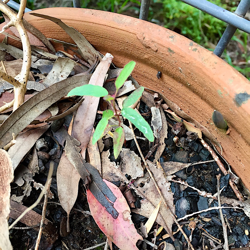
After a year or two I thought I should find out if this was a good thing or not as this spring it is growing vigorously.
Having determined that it is probably a Desert Ash, a plant formerly used for street trees but now regarded as a pest because it reproduces so readily, it has to go.
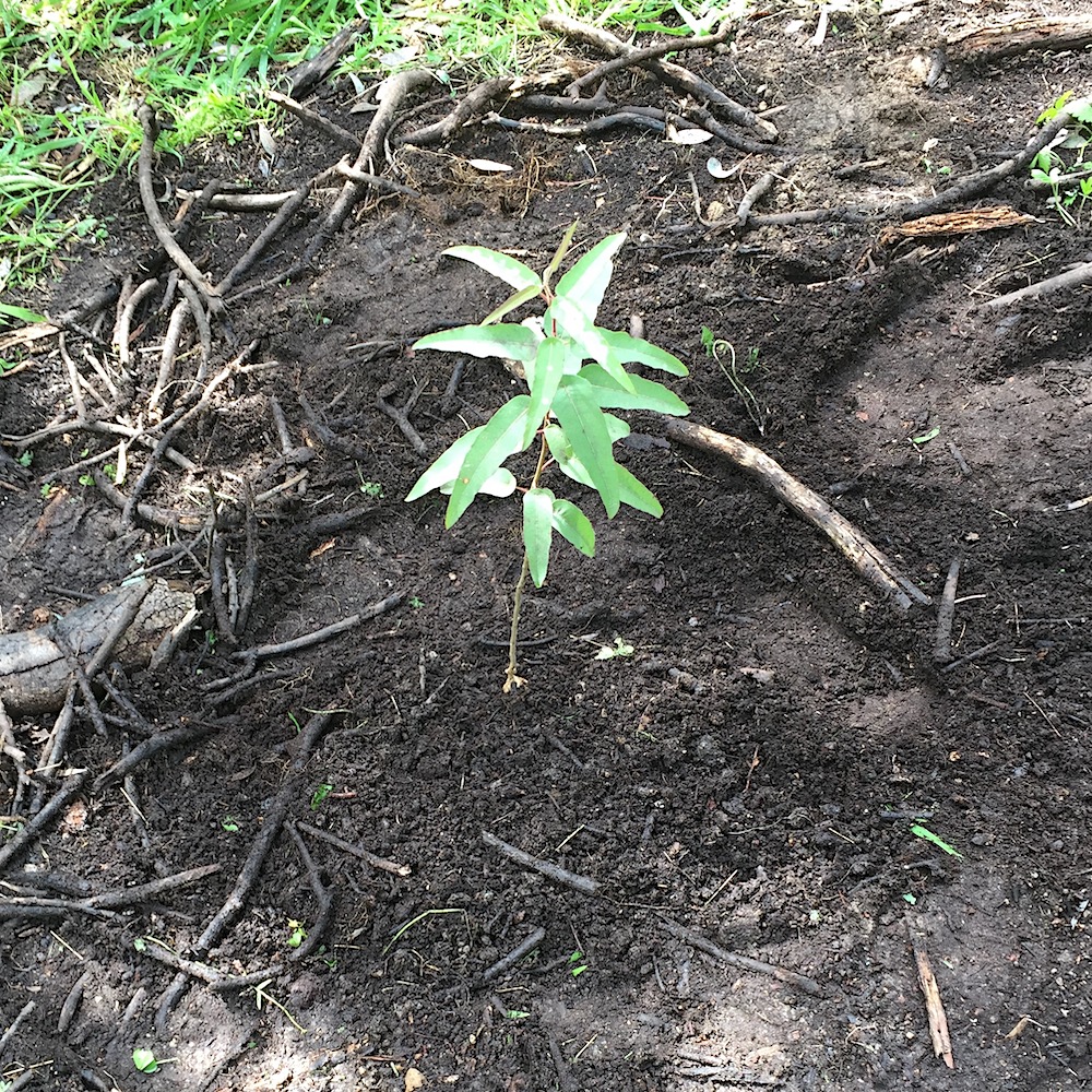
This little tree planted itself in a pot next to the front steps.
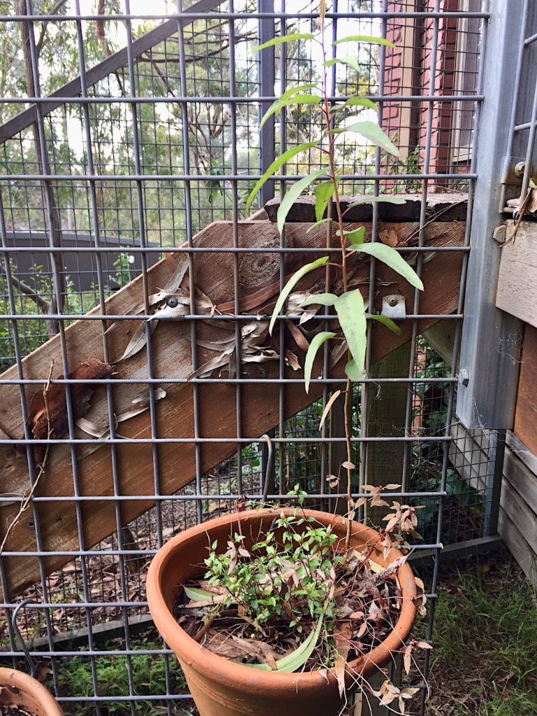
In the pot next to this one is a tree that self planted a few years ago and it is now time for it to move on. Both are from the Lemon Scented Gum, easy to identify by the shape and smell of the leaves.
The new location for this plant is obvious, down the drive in the recently vacated space.
While autumn is a better time to plant native trees, a week of forecast rain and daily monitoring as I collect the morning paper, it should be ok. Good luck little tree.
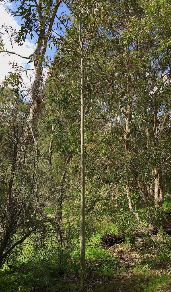
Here is one from the same source I planted ages ago, growing straight and true.
In May 2020 when the people of Victoria were confined to their local neighbourhood I started walking the Mullum Mullum Trail. From my home I could get to the source of the Mullum Mullum Creek in Croydon North and as far downstream as Ringwood.
Then when restrictions were lifted I was able to complete the journey all the way to the confluence with the Yarra River in Templestowe.
Along the way I discovered many new things and learned a lot about the way the creek has been used and abused, valued or not, over time. I have grown very fond of this little stream. Here is the full story.
This special place has a heritage of many thousands of years occupation by the Wurundjeri people. The confluence of the Birrarung (Yarra River) and Mullum Mullum (Creek) was an important recreational, hunting and fishing area. For a period of months each year, the Wurundjeri lived here in permanent bark dwellings. There was a river crossing, fish nursery and freshwater mussel farm. On the hilltops, grass seed farms and myrnong farms in the gullies.
Along the Yarra River’s southern bank a travel route was maintained by regular burning. A Songline from this place follows present day Warrandyte Road, Tindals Road and Old Warrandyte Road to Andersons Creek. At Pound Bend there was a final great intertribal corroboree of the Kulin people in 1853. This was organised by Simon Wonga to allow his people to draw the curtain on their traditional life and find a way to survive in the new world that had been thrust upon them. For fourteen days and nights in March 1852 the Kulin people held traditional ceremonies and played the traditional game of marn grook. This information is from a 2018 paper by Jim Poulter and Bill Nicholson
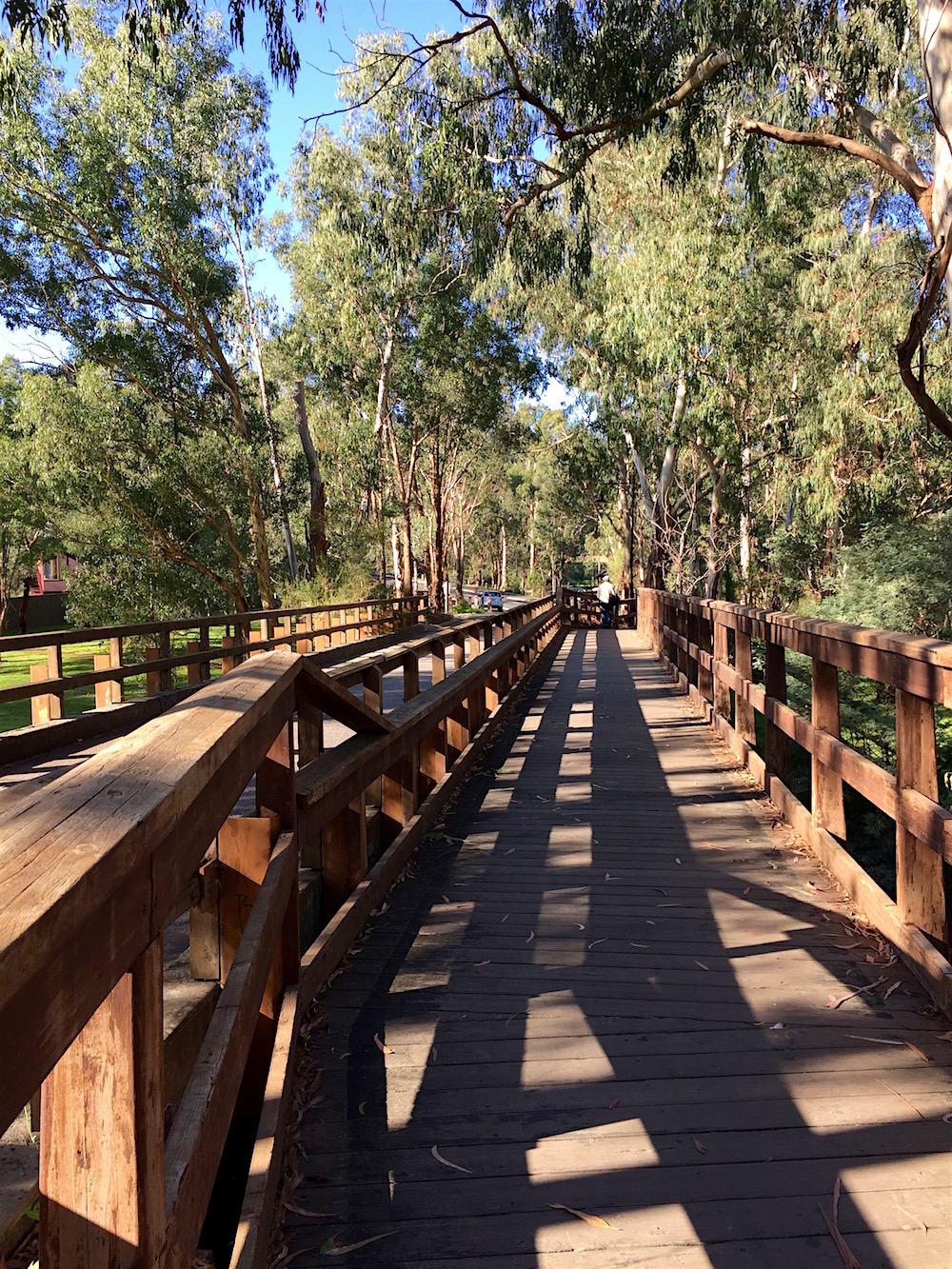
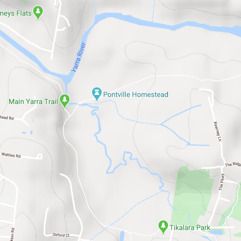
The boardwalk of the Main Yarra Trail takes you past the last stretch of the Mullum Mullum Creek and then you can see the Yarra River flowing down from the aptly named Laughing Waters. There is are resilient populations of platypus in the creek and this is a breeding area.
Through the trees on the opposite bank of the creek is Pontville Homestead, Victoria’s earliest pioneering residence still on its original site. In 1837 Major Charles Newman first cleared the area for grazing livestock. After violently dislocating the Wurundjeri people from their permanent campsite on the high ground he built the homestead, completing it in 1844.
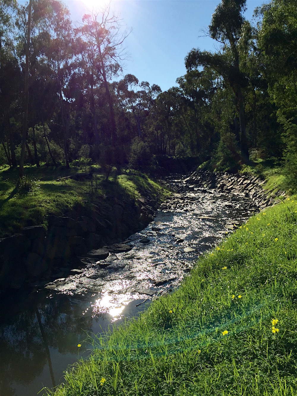
A viewing platform is right at the confluence of the Mullum Mullum Creek and the Yarra River. It is the most beautiful, peaceful and haunting location.
This video was filmed on a sunny day at the end of June, when it was still permitted to walk in areas away from your home. I am so glad I snatched the time between two COVID19 lockdowns to walk the full 22km length of the creek and more!
My long journey following the Mullum Mullum Creek is nearly at an end. My last day of walking started near where I left the creek next to the Templestowe Terminal Station.
Getting into this area by car is a little tricky. By following the extension of Blackburn Road across Warrandyte Road you end up in the Templestowe Industrial Estate, then you go between some stone gate posts into The Parkway, this road has parkland on one side and the terminal station on the other, it turns the corner, crosses the creek on a single lane bridge and suddenly you are in the middle of a small, very up market housing estate.
The bridge is also part of the Mullum Mullum Trail. I didn’t know it at the time but this was the last view I would have of the creek for quite a while.
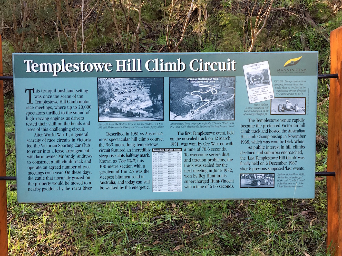
The housing estate is on a very steep hill that was formerly the Templestowe Hill Climb. There is now a walking trail on part of the old track. There is a lot of information on the sign at the base of the climb.
Built by the Victorian Sporting Car Club in 1951 it was famous for the steep climb halfway along known as The Wall. From a 2003 Age article about the course:
The farm at the top of Blackburn Road was home to an implausibly steep rise, effectively an escarpment, on which a section of track was built that was known as The Wall. It stretched for about 100 metres at a gradient, measured in feet, of 1 to 2.5. Hill climb competitors, who are usually amateurs driving their own cars, race against the clock over a course from A to B. At Templestowe, the track was 969 metres. The rise of The Wall at the halfway mark gave it something special. The track was unsealed at the first event, held on March 12, 1951. The dust was shocking but the greater problem was the inability of tyres to grip the shifting surface of The Wall. Most cars slid to an ignominious stop in The Hole. By the second Templestowe hill climb, more than a year later, the track was sealed and The Wall was the steepest section of bitumen road in Australia. Any steeper and the tarmac would have slid down the hill before it had set.
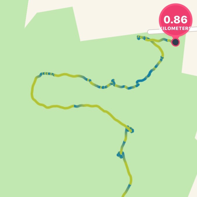
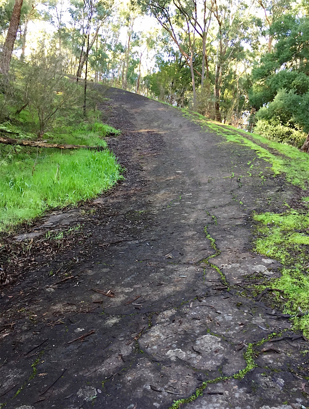
Images from Speedway and Road Race History give an indication of what it was like to drive up this almost impossible slope. And here I was about to attempt to walk up it on a winter day when it was covered in slippery wet leaves.
I started out well, pausing to take a photo every now and then, but once I turned the bend, the slope increased and I wondered if it was a road too steep. The screenshot from my fitbit tells the story. Green is a normal pace, blue is virtually standing still.
At times I thought I was going to fall off the face of the earth!
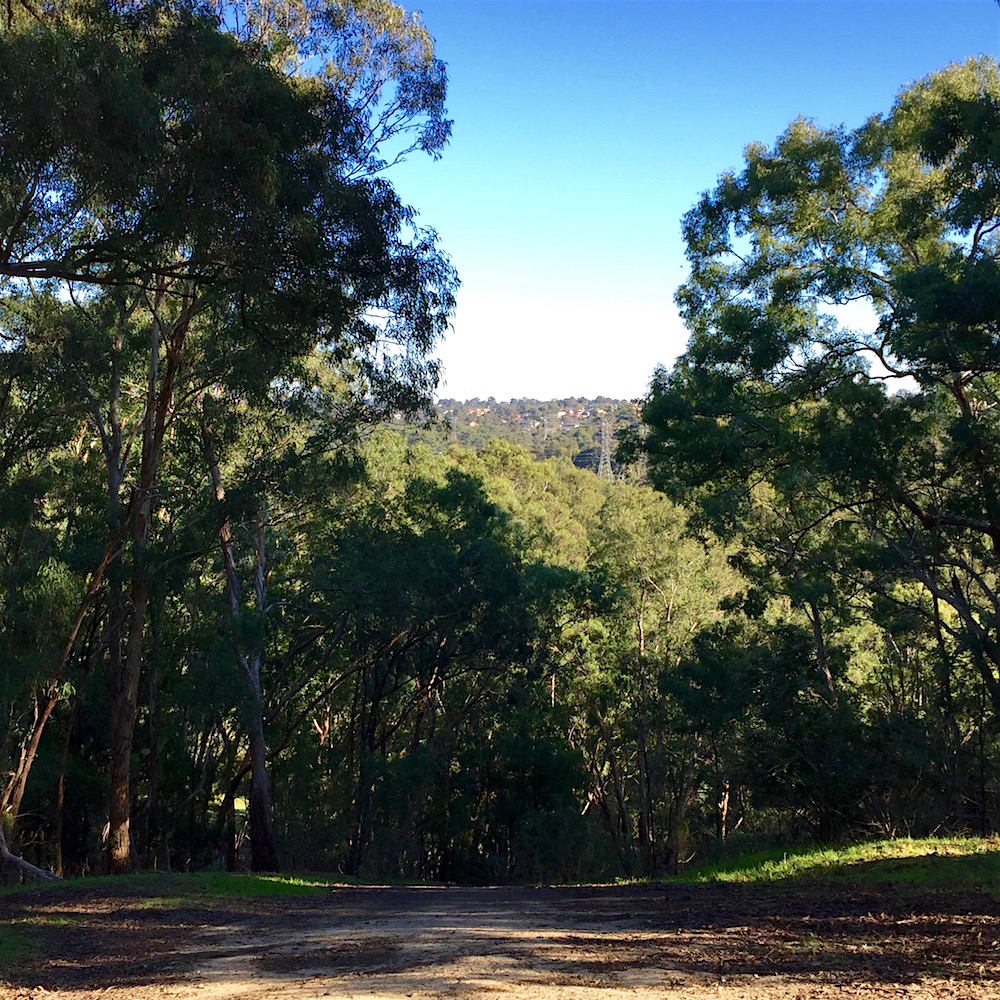
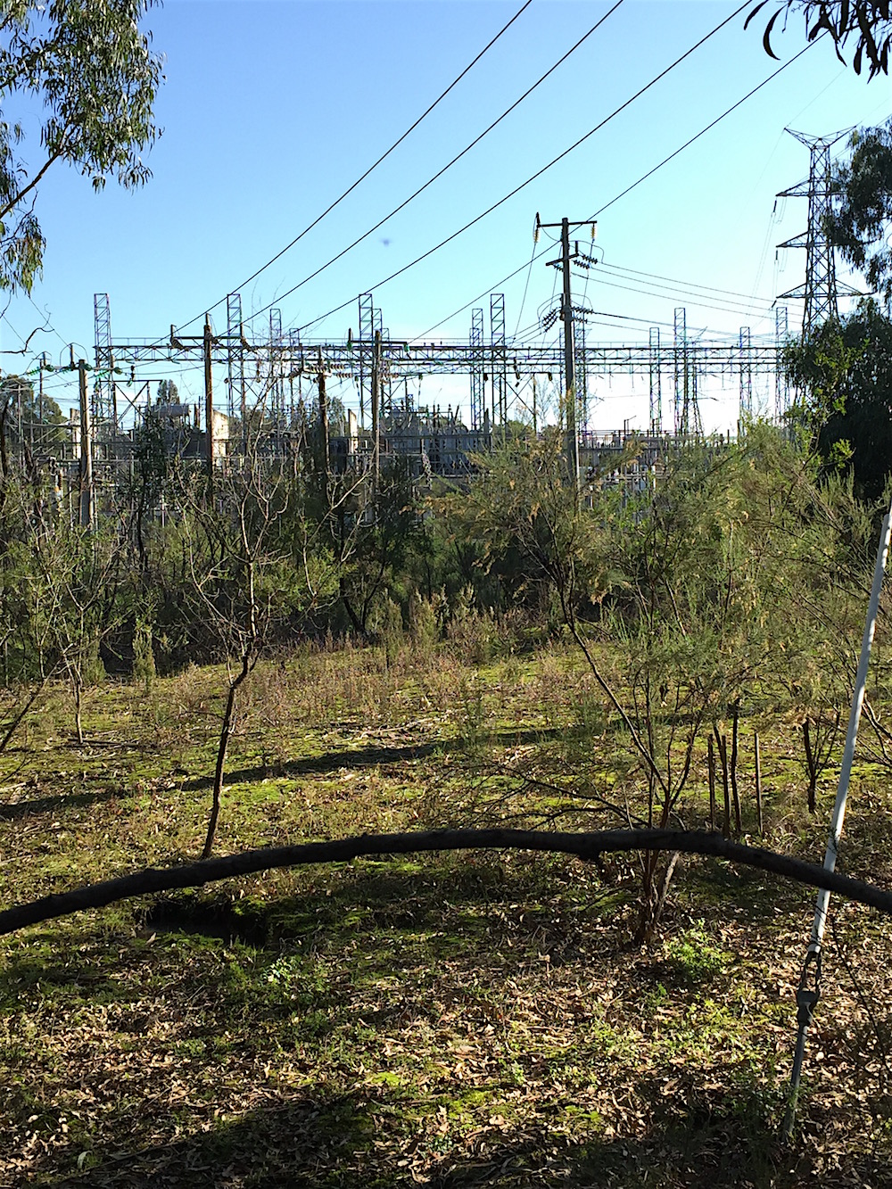
However I did successfully make it to the top. Trees have grown but you can still see the same view, with the pylons far below.
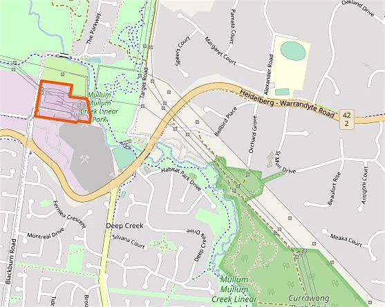
After this challenging diversion it was back the the Mullum Mullum Trail. It goes through Tikalara Park which is actually most of the area of this map. The Hill Climb is near the top of the green area; the dark smudge is The Wall.
The first section of my walk is the horizontal bit at the bottom, up to the small watercourse.
After crossing the bridge, and before crossing The Parkway I could see another mob of kangaroo enjoying the sun. The trail turns uphill away from them and follows the powerlines. At the end of this section is a stencil, this is the end of the Mullum Mullum Trail. From here on I follow the Main Yarra Trail, which you can see coming up from the bottom of the above map.
After crossing the little tributary, it is not long before I am in a delightful avenue. Each of the trees has an individual number tag, I assume it is part of Parks Victoria’s management.
The path follows the contour line, slightly above and well away from the creek itself. This section of the river flat between the path and the creek is manicured grass.
Then, after going through a gate the path is still elevated and there is a wetland full of frogs. I did venture off the path and across to the creek, picking my way very carefully to avoid the boggy bits. Here there were more kangaroos, not so used to people I suspect as they left very quickly.
The trail and creek finally meet again near the last bridge. Unfortunately, while maps have a walking track crossing this bridge and heading back east, this is not possible.
The direction sign to this track has been removed from the board and the bridge is well and truely closed. Now the only option is to head to the City 36.5 km away.
Following that trail, onto a boardwalk here there is a good view of the final bend in the Mullum Mullum Creek…
Roads do a lot of damage to creeks. Here is the Mullum Mullum Creek as it goes under Warrandyte Road. Obviously the council does not want to risk losing the bridge when there is a big volume of water.
Before I can follow the creek back to my car parked at the Currawong Bush Park, I have to find a way around the Crystal Brook Caravan Park that occupies the east bank. They are rather risk averse at this tourist destination.
From the entry road you can see the almost complete loop the creek makes as it twists and turns, leaving the hills and heading into its open plains section in Templestowe.
But I am going upstream, back into the hills and this means climbing some steps.
And then some more steps until I am high above the creek.
The view is across to the hills of East Doncaster. The blackberries are on part of the land occupied by the tourist park. There were wrens darting in and out and a Crimson Rosella feasting too.
After all that going up, there is the coming down. The track is on the power line easement, quite a nice walk if you don’t look up. The steps are a little slippery, another reason to keep your eyes on the ground.
Finally back at the creek there is a sign for walkers coming in the other direction to make sure they don’t stray where they are not welcome.
Currawong Bush Park is a 59 hectare council owned park that stretches from here all the way to Reynolds Road. Much of this top section is the bank of the creek and the power line easement. After following the path for a while there was a sign giving me three options.
Ruby’s Track sounded promising, but I took the diversion to the left first. This lead to the Billy Baxter Wetlands. Part way there this roo bounded across in front of me and made me jump too.
The series of ponds filter runoff from nearby properties before it enters the creek. They were alive with calling frogs and a couple of ducks. A very peaceful spot.
Back on the track which roughly followed the course of the creek I soon spotted the reason for my interrupted walk earlier in the day.
A huge manna gum lies fallen along the Mullum Mullum Trail. I am not sorry however that I couldn’t walk that section. This route is far more to my liking.
Although late in the afternoon there was still time to explore the bush park, so I turned onto the fire track circuit and before very long found myself in the middle of a large mob of grazing Eastern Grey Kangaroos.
At first I didn’t see them at all. They blend perfectly in with the shadows, trees and fallen timber. As I moved along the path they ignored me, but if I stopped up they looked up to stare back. Then there were some on the other side too, that had me a little worried. But they bounced up the hill.
Most of the females had joeys in the pouch, one joey, nearly as big as its mother was suckling. You can see what happened next in this video.
The park is well worth a visit. The before its time modernist former home of Robin and Bunty Elder now a conference centre. There are picnic areas, sculptures and many interpretive signs for schoolchildren and associated audio guides. The bushland had become very degraded and now is more park than bush in this main section.
Currawong Bush Park sits on land of significance to the Wurundjeri Willam people. There are a few scar trees and a stone artefact find near the creek. The scar tree near the highest point has fallen, although a sign shows its location. I got distracted watching a pair of galahs working at a nesting hollow and did not take a photo of its location. This one is from Film Victoria.
The sun was very low in the sky by the time I got to Miller’s Pond, just below the carpark.
The section of Mullum Mullum Creek covered in this post goes through one of the last tracts of orchard land and bush in Doncaster to consumed by suburbia. It is bounded south and north by Reynolds Road and Warrandyte Road, to the west Andersons Creek Road and transmission lines to the east.
Here it is in the 1977 Melway Street Directory map of the area. The image is from the University of Melbourne Library digitised collection. This is an excellent resource for exploring changing land use since the 1960s.
This locality was known as Deep Creek, the alternate name for Mullum Mullum Creek. In 1878 the Deep Creek school was built in Andersons Creek Road, just south of Reynolds Road, but enrolments fell because the expected village near the creek did not eventuate and in 1887 the school was moved 3 km south and became the Doncaster East school. Now a quiet connecting road, Anderson’s Creek Road was once the only route to Warrandyte, formerly known as Anderson’s Creek.
A bridge was not built on Reynolds Road until the late 1960s and Springvale Road that now forms a busy intersection near the creek did not go all the way to Reynolds Road until the 1980s. So this area remained rural until almost the end of the 20th century.
A large bush park is on the western side of the creek. Originally owned by an orchardist, the land was not cleared because of it steep slopes and rocky soil. In 1957 Robert Elder, a solicitor, bought 24 hectares on Reynolds Road and built his family home. The site remained as bushland and was compulsorily acquired by the MMBW in 1972 as part of a plan for a green ring around Melbourne. More on this later, but for now this is where I parked my car and walked down the hill to near the Reynolds Road bridge and the start of the day’s trek.
The valley is wide and benefits from views through to the bush on the other side of the creek. Except for traffic noise that never quite disappears, it is a pleasant walk. That is until a kilometre from Warrandyte Road the path is once again blocked.
A cyclist was clambering around the fence, bike held above his head. He told me it the trail was closed at Warrandyte Road and he had used streets to get most of the way. As I had planned for my return journey to be on the other side of the creek, I followed the detour sign up into the suburbs.
Deep Creek Drive is a recent revival of the area name, it winds through the new subdivisions. I had one last glimpse of the trail, between two houses, before turning west and climbing further up the hill.
This is the land of oversize houses on steep blocks, the gardens clipped to attention.
Melway Street Directory 1986
Arriving at last a Warrandyte Road I looked for evidence of the final private school built adjacent to Mullum Mullum Creek. But nothing remains of the short lived Kingswood College Doncaster, another school built in anticipation of a growing population, but ahead of its time and a victim of the late 1980’s recession.
The collection of portable buildings was acquired by Box Hill TAFE, but this failed too and the space is now housing and part of the Mullum Mullum Trail.
Across Warrandyte Road is the Deep Creek Reserve, home to a rather impressive baseball diamond. The creek runs alongside and the path follows a boardwalk and then a bridge.
If you look at the above map you can see the creek then goes through the Templestowe Terminal Station. The high voltage powerlines that have shadowed my journey all the way from Ringwood bring the Latrobe Valley electricity to this point. While they are not very attractive, at least the easement has made the creation of a bushland trail a little easier. As seen on the openstreetmap.org plan below, the terminal station now occupies a much smaller area and a large portion has become public land.
This map also confirms something I had long suspected. Alongside the transmission lines coming up from Ringwood, there is another line coming in from Coldstream. This goes through South Warrandyte and I frequently pass underneath. In misty or foggy weather the lines are silent, unlike the buzzing I have heard on the line in Ringwood. You can see the towers are shown on the map, but there is no wire connecting them. That is because the line is inactive, it was turned off when a new route north was built. The wires exist, they just don’t do anything.
The creek runs beside the fence and the path wanders through the slowly regenerating bush. The kangaroos that frequent the area ignore the warning signs.
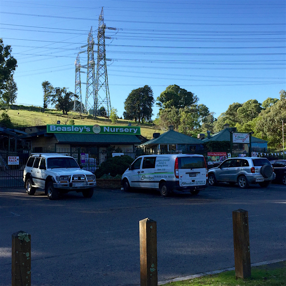
Time to head back. But not before stopping in for a coffee at Beasley’s Nursery.
After the discovery of gold near Bathurst, NSW in February 1851, a gold discovery committee was formed by the Victorian Governor in the hope of ending the mass exodus of the population from the new colony. A £200 reward was offered for the discovery of gold within 200 miles of Melbourne. As gold had already been found there were a number of claimants and who was first is still a matter of dispute. The reward was divided up and it appears that the first acknowledged find was not far from the Mullum Mullum Creek.
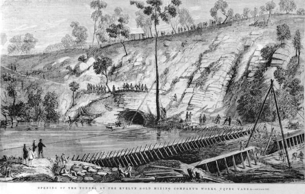
Reported as a find at Deep Creek (Mullum Mullum Creek), the actual discovery was in Andersons Creek in Warrandyte. In 1935 a cairn marking the site of the first discovery of gold in Victoria, was erected at the creek on what is now called Gold Memorial Road. Naturally people rushed to the area in the hope of finding their fortune, and just as quickly rushed on to the next site when pickings proved scarce. Over the next 50 years or so mines were dug and then abandoned. The most well known engineering feat is the Pound Bend tunnel, dug in 1870 to divert the flow of the Yarra River to allow the river bed to be worked for gold.
Drawing of the opening of the tunnel from the Warrandyte Historical Society
All through the gullies and hills around Warrandyte there is evidence for the search for gold. The 1893 Geological Survey held by the State Library of Victoria shows numerous quartz reefs and workings near the point where my Mullum Mullum Creek walk resumes. The circled 19 on the map indicates a specimen held at the Department of Mines and it is where I start.
The landscape around the section of the Mullum Mullum Creek west of Park Road still contains evidence of gold prospecting .
Somewhere on this steep slope leading up to McIntyres Road is a Heritage Listed Adit. This is a tunnel going into the hill and the heritage listing confirms it is a gold mine, possible going in about 50m and then a vertical shaft of unknown depth. It is assumed the miners were following gold in a quartz vein. There is also evidence of a path, a culvert and quarrying on the bank of the creek. All this is very overgrown and the adit is on private land.
The bank of the creek is obviously very susceptible to erosion and damage. Because of all the previous activity in the area, the original course of the creek is unknown.
Fortunately a board walk takes the trail through this part of the creek valley.
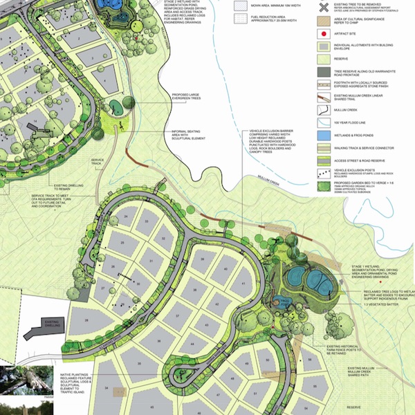
The the valley opens out a little, and getting closer to Tindals Road there is a new residential development with large lots and a respect of the natural environment.
Click to see full landscape design and planting list
Designed to preserve existing Manna Gums, Yellow and Red Box and Candlebarks, the Mullum Creek estate also has building design guidelines to …promote high-quality, attractive homes that will meet high standards of environmental performance. The project won the Best Natural Built Environment Award in the Victorian Landscape Industry Awards 2018 with the Judge’s comments – “The project at Mullum Creek in Donvale is a fantastic exemplar of a natural built landscape. The hydrology and ecology of the site has been well-considered, with runoff from the development site treated by a constructed wetland before it enters the nearby Mullum creek. Indigenous plantings have extended the remnant vegetation into the landscape and wetland, from seed previously collected from the site. Furniture, fences and bollards were milled on-site from timber that was already on the property. Much thought has been put into making the Mullum Creek development a beautiful, sustainable landscape.”
From the trail there are pleasant views of the wetlands and the interesting homes, some with very expensive landscaping. At Tindals Road again the route is uphill to a safe crossing and then down to the creek again.
Suburban development is very much in evidence on the south of the creek where the trail intersects with a number of streets and courts. On the north side it has remained open land, so that is the route I took.
This path goes through an area that was used for equestrian cross country events. The council purchased an adjoining old orchard for extra space and then negotiated with the riding club to exclude horses from the vulnerable wetlands and creek banks. A board walk was installed to further protect the area.
But of course you can’t stop kids doing what they have done for eons. Mucking about at the creek. As I followed the path above the creek I could here shouting and laughing and general daredevil carrying on. I couldn’t see anyone though. Then at last I spotted the schoolboy on the other side of the creek. His mates were under the rim of the bank on my side, trying to walk along the very edge of the water without slipping in. One was worried about his shoes and how could he go back to class all muddy. They were in uniform, from Donvale Christian School that is not that far from this spot, just back a bit and up the hill. So this is private school number three on Mullum Mullum Creek.
If I had been on the other side of the creek, following the Mullum Mullum Trail I would have seen the next school. I did on my return trip. Have I mentioned that because I drive to my start point I walk every section twice? I try to find a different route as I did on this day, but it is not always possible.
Through the trees you can see the Donvale Junior School campus of Carey Grammar. It has an interesting history. Way back in the early 1970s when I was a student teacher there was growing interest in alternatives to the traditional school. A. S Neill’s Summerhill in the UK was the exemplar we studied. In Melbourne a group of parents decided to create the first alternative secondary school in Australia. It was called Era, standing for Education Reform Association: – a little from http://www.era-school.net
Bus stop late 1975
The most obvious difference between Era and traditional schools was the relaxed disciplinary environment in which students could wear what they want, call teachers by their first names, attend only classes of their own choosing (or none at all ) and take part in much of the school’s decision making process.
After the school closed in 1987 due to financial difficulties the site was purchased by Carey – a school in Key with no Yarra River frontage for rowing practice; perhaps they thought creek frontage would be good enough. (This is a reference to an old rivalry between this school and its sister school that I attended which had purchased a Hawthorn property on said river when I was there.)
Back to the Trail. The valley is now quite wide, a large almost flat area is Buck Reserve, home to the Donvale and Templestowe Pony Club.
No meeting on the day I was there, so I could take a path through the reserve as the way by the creek was very muddy. I discovered later that the club house was not originally on this site, it didn’t look like it would have been an old orchard home.
The creek just before it goes under Reynolds Road and a tree by the foot bridge. Marvellous.
As I joined the Mullum Mullum Trail once more I saw the section I had missed is all hard paved with mown lawns and skirts a large carpark and indoor sports stadium. I was very glad I had taken the less travelled route.
Fortunately the information sign at Heads Road Park Orchards is out of date. The Mullum Mullum Trail continues on to Park Road. It was the last section to be completed, finally opened in 2018. The project was on hold for some time because of the construction of a sewer main in the same space and this work had delays.
A photo from bicyclenetwork.com.au shows the last of the prefabricated bridges being lowered into position. No small structure it is the first bridge found immediately after crossing Heads Road.
This is a beautiful and quiet section of the Mullum Mullum Creek. Most of the trail is on boardwalks, passing lots of big trees which were being enjoyed by noisy galahs on the day I walked on through.
The creek itself is lovely, it twists and turns around and over natural rock forms.
I took a short video which include the birdsong that adds to the enjoyment. You can find it here.
Some of the houses in this valley have been here for decades and blend into the bush. Nearing Park Road there is a fence and gate. This is the Whitefriars College, the second of the private schools that are on the creek.
The trail runs up the hill along Park Road to a safe crossing point. Along the way it is hard to ignore the huge white house that also dominates the last section of the valley walk. While it is architecturally interesting it is a pity it is not more sympathetic to its surrounds.